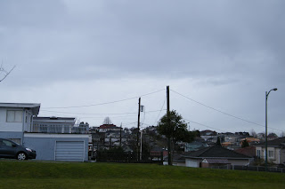
I walked to the park down the street, which is an awesome spot to survey the cloud cover and formation all over the city. To the NNE, I could see some rain falling from a collection of what I would call cirrostratus clouds, but with the addition of rain, I suppose they would simply be called stratonimbus clouds. The entire sky is cloud covered at the moment, and the clouds coming from the west are textbook altostratus-a darker featurless layer of cloud that looks to be of mid-height classification. Its chilly and a bit windy, and the air felt wet although it wasn't raining at the time. I have a feeling I'm in for sections of rain and cold gusts as I take transit across the city to school.
The weather office provides these readings for the moment:
- Observed at:
- Vancouver Int'l Airport
- Date:
- 11:16 AM PDT Monday 14 March 2011
- Condition:
- Light Rainshower
- Pressure:
- 100.0 kPa
- Visibility:
- 19 km
- Air Quality Health Index:
- 3
- 7.7°C
- 4.8°C
- 82 %
- SSE 21 km/h
Taking a look at the currently available surface maps, Vancouver is sitting under a huge low pressure system, and a sizeable occluded front is sitting right over the city.
Cloud Formations visible to the West:

As these layers are "featureless" we have ourselves some stratus clouds!
These far more interesting photos were taken facing NE:


No comments:
Post a Comment